May 18, 2022
An Ibaraki Hike on the Kanto Fureai Nature Trail
In November 2021, I told you how I’m looking forward to visiting the underappreciated Ibaraki Prefecture. This part of the Kanto region is not high on visitors’ priority destinations which makes it a less crowded space to take your time and explore the natural beauty there.
As part of the Kanto region, Ibaraki’s hiking routes are included in a network of paths referred to as 関東ふれあいの道 Kanto Fureai no Michi, and alternatively 首都圏自然歩道 Shutoken Shizen Hodo. The nature trail network circles nearly 1800 kilometers through Tokyo and six prefectures. The individual trails average around 10 kilometers in length and though they don’t all directly connect to each other, the routes start and end near rail or bus connections. The routes are planned to afford hikers scenic views, forest and mountain walks, and highlight cultural and historic spots.
One of my favorite routes in Ibaraki Prefecture is the roughly 8-kilometer walk labeled 御嶽山から坂東24番札所へのみち, the Mt. Ontake to the 24th Bando temple trail. This is where nature and culture come together as the hike and the Bando 33 Kannon temple routes overlap.
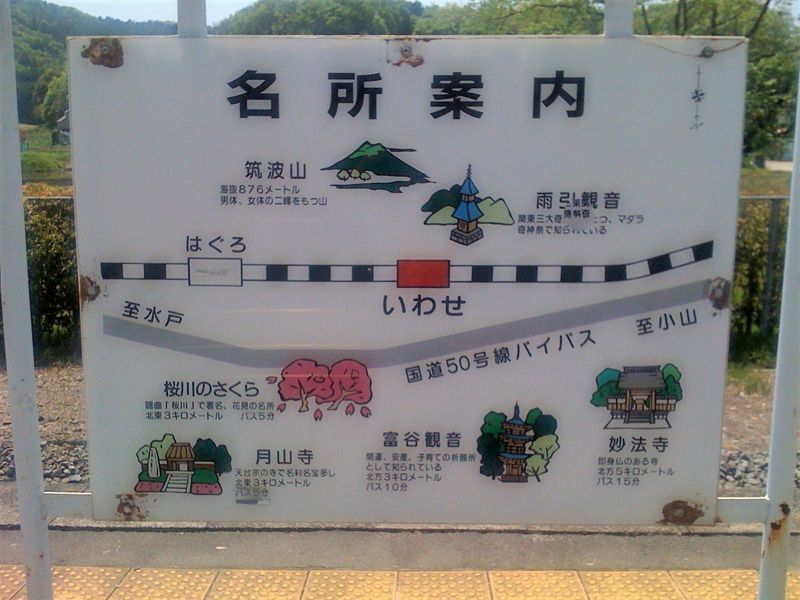
The wayfinding map at Iwase Station indicates Amabiki Kannon temple and Mt. Tsukuba
Starting at Iwase Station on the Mito Line, the trail takes you through dense forest, past shrines, and a waterfall used in Shugendo practices, and gives way to wide views of the valley to the west. Further along the trail the edges of the satoyama or cultivated and wild landscape come into view. I noticed cultivated patches of land that thin the forest and make it more accessible to people and wildlife.
On my way, I heard a buzzing sound coming from a cleft in a tree. A wild bee colony! Butterflies and other insects thrive here, too, and I saw little blue butterflies dancing over lilies that were probably planted by local farmers.
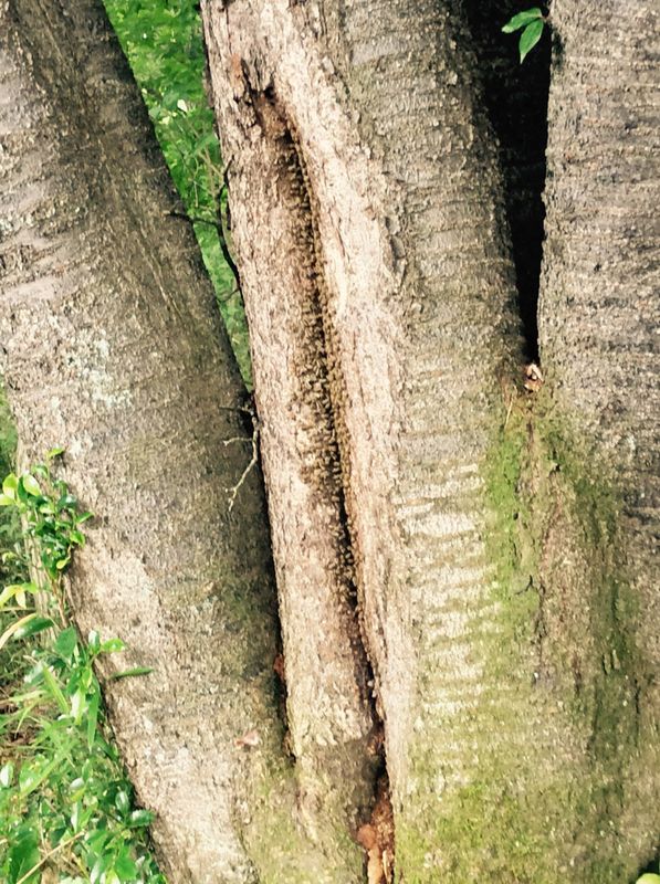
A wild bee colony
The trail begins to wind up the flank of Mt. Ontake and you’ll need sturdy footwear for this. Most of the trail is just a rough path but to get up to the mountain you’re faced with seemingly endless timber stairs. The reward is a lookout at the top and further on, the 24th temple of the Bando Kannon pilgrimage.
I always know I’m nearly at Amabiki Kannon temple, the 24th on the Bando pilgrimage because I can hear the temple’s peacocks calling. They’re free-ranging birds that you can spot (or they spot you and call out!) just off the forest path. Around the pond in front of the temple ducks and chickens gather, too.
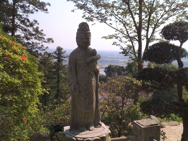
Buddhist statuary in the temple garden overlooking Sakuragawa City
The temple has a hall where visitors can rest and have a cup of tea before the walk down to catch the bus back to Iwase Station.
Now, I’m planning hikes on Fureai no Michi routes through rural Chiba Prefecture, too, for getaways on weekends.
Have you hiked the Fureai no Michi trails in the Kanto region? Which are your favorite trails?


0 Comments